To be honest, we had no idea what to buy in the market place of Dehradun, so we decided to stroll around and pick some things that we would need on our upcoming trek to “Har Ki Doon”, we came across two young guys from Kolkata, Prasanta alias Prasantada and Tarun, both employees of C. E. S. C. Kolkata. And in no time we were bonded into friendship when we came to know that our next day’s venture was same to explore “Har Ki Doon”. After procurement of our purchase we came back to our hotel and incidentally we all put up in the same hotel. So after repacking our goods we came to the lounge of the hotel to have tea and revise our plan of the tour.

Prasantada was the senior most in our group and a trained mountaineer also. So unanimously he was accepted as our leader by automatic choice. He was a member of the “The Himalayan Club” of Kolkata. While I briefed our trekking programme, he told us that unlike ours they had a plan to cross “Jamuna Kanta”, the pass on the Bandarpunch” range and descend via Jamunotri instead of coming down to the road head along the same route. They came prepared for that mission equipped with tent and other gears. So initially it was decided that we would go together up to Har Ki Doon, what was our primary objective. We came to our rooms after having our dinner retired to bed.
Must Read: A Rainy Day Out by Asis Mukherjee
Next day morning we all got ready early in the morning and left the hotel to catch the bus for Netwar. At the bus stand when we booked our tickets we came to know that the bus was plying up to Mori, ten kilometers ahead of Netwar due to road damage between Netwar and Mori. We had to accept it. Earlier the bus was plying up to Purola. Off late it was extended up to Taluka. But in Himalaya one must be prepared for any uncertainty. The bus started around eight thirty in the morning. We occupied our seats and put our rucksacks on the roof of the bus. Up to Purola the condition of the road was good. But despite that, the local bus took an unusually long time. We managed to have our lunch at Purola and again started for Mori. We observed the condition of the road was worse. By evening we reached Mori. We brought down our rucksacks from the roof of the bus and began to follow the local passengers heading for Netwar. It was around ten kilometers. Evening set in earlier in September. Before we reached Netwar it was dark enough to bring torches. We followed the men ahead and cautiously crossed the damaged portion of the road where a bridge was completely washed out. After a while we came to Netwar forest bungalow. Fortunately the caretaker of the bungalow was available at the bungalow and we could check in. He helped us a lot. He prepared tea for us and also cooked rice and we brought out our tinned chicken curry for our dinner. Around nine we slipped into our sleeping bags and in no time our fatigued body fell asleep.
Must Read: Beyond The Singalila Ridge by Asis Mukherjee
Next morning when we woke up and came outside of the bungalow with our cups of tea we were awestruck at the beauty of the Netwar bungalow and its surroundings. The altitude of Netwar is 4600 feet. The deep gorge of the river Tonse was seen from the compound of the bungalow but the flow of the river was not visible from this place, only the gurgling sound of the river was heard. It was a confluence of the Rupin river coming from the right bank of the Tonse. We would go along the river Tonse towards its source. After breakfast we set out for Taluka, our today’s destination via Sankri. In no time we entered into the forest of chestnuts, oaks and pines but the road up to Sankri was being built for bus, so the condition of the track was very good for trekkers. In near future the buses would ply up to Taluka and then trekkers would certainly loose an opportunity to enjoy hiking through this dense forest. But now we’re enjoying our journey through the dense forest. We could only have a glimpse of the monkeys and different varieties of birds. Though local people told us that bears and leopards were available in the forest but we were fortunate not to encounter any of them. Even though we were walking together. In two hours we reached Sankri. We came across a tea shop and the Supin river, another contributory, coming down to meet the Tonse. So we selected a nice place to have a break. After some time we again resumed our journey. Today’s total distance is twenty kilometers. So far we had covered eight kilometers, less than half of the total journey. So we tried to cover the rest of the trek a bit faster so that we could reach Taluka and had our lunch over there. Because of the comfort of the route we reached, in the next three hours, Taluka at around 2 p.m. We checked in the forest bungalow and tried to prepare our lunch. The chaukidar also came forward to help us. Around 3 p.m. after having our lunch we felt comfortable and relaxed. On our way to Taluka we crossed two waterfalls which contributed their waters to the river Tonse. We walked along the left bank of Tonse and enjoyed our journey beside it all through. The Taluka bungalow offered us a wide space to enjoy our leasure at the balcony of the bungalow. The green fields of cultivation spread towards the bank of the river. The giant trees of the forest were set aside. We sat there for hours until sunset. Evening spread a curtain of darkness all over the valley and cold wind drove us inside the room. We observed that all the forest bungalows on our way were very good and well maintained. We had our booking from Kolkata through the Divisional Forest Office, Purola. We also noticed the board of the Forest Department on our way marking “Govind Pashu Vihar ”. We are now in the reserve area of the forest. The altitude of Taluka is 6500 feet. So today we gained a height of around two thousand feet. So far we traversed through a good path because it was prepared to be motorable in the near future. But the more we marched ahead the more we entered into the deep forest. But from the compound of Taluka bungalow we could not even realise how wild and dense could it be. We also observed the planks of wood were flowing down the river. The natural transportation system of the wood cutters in the upper region of the forest. We had seen how the resins was extracted from the Pine trees in the forest. The forest here provided the bread and butter to the local people. With cups of tea we sat together in the room and I was telling my friends that we traversed through mythology and entered into the territory of the Kauravas of Mahabharata. The entire region along with the banks of the river Tonse was the kingdom of Kauravas and in many villages in the temples Duryodhan and Karna are still worshiped as local Gods. The story seemed unbelievable to my friends but I assured them that we would certainly come across on our way. Local people also believe that Pandava so went to their final departure from earth to heaven along this route because at the end of this route there stands the peaks of the Swargarohini means path to heaven and from that peaks descends the Jamdwar glacier which means the door to the next world after death. These mythological references give the trek a different dimension. Meanwhile the chaukidar of the bungalow prepared our dinner and called us. We noticed that the clock struck 8 p.m. So we moved for our dinner and called it a day.
Must Read: Lonely Planet Travelogue by Asis Mukherjee
Next morning we as usual started early after having our breakfast. Today’s distance is around 14 k.m. but we have to traverse through dense forest along the foot track of the villagers. We’ve been on the trail for three days.. I was marching ahead followed by Pradip and then Prasantada and Tarun. The team automatically broke due to the different pace of the individuals. Sometimes the foot track came down to the level of the river bed, sometimes it was going up. At one point I noticed that the foot track was bifurcated and one track went to the right and upward direction. I paused for a while and decided to follow the left side narrow path through the dense forest along the course of the river leaving the right side a comparatively wider track. I thought twice before proceeding and put a cairn for my behinders so that they could follow the right direction. I was marching non-stop and sometimes I felt uncanny amidst the deep forest alone. Perhaps the feeling forced me to walk relentlessly. The track went through the course of Tonse. I am now confirmed that I have chosen the right track. After four hours and a half walking I came out of the jungle in an open field. I found green pasture of cultivated fields and my foot track went through the field of red and green. On one side of the field was the cultivation of Ramdana, the local name of a corn which was red and on the other side of the field was the cultivation of wheat which was green. I was lost for a while amidst the colours of life and the sign of human beings near by. I stopped for some time after a long march. I found local women working in the fields and their houses nearby. I regained my energy after seeing them. I resumed my double energy and in no time I came to the village and found the forest bungalow. I noticed the signboard “Forest Bungalow, Oshla, elevation 8400 feet, Govind Pashu Vihar.” I gradually entered the compound and put down my rucksack. But to my utter dismay I observed that the bungalow was preoccupied by a large group of people and porters. I could not understand who they were and when they had come because we didn’t find anybody crossing us on the way. Meanwhile the chaukidar, Bhajan Sing appeared. He told me that a team from the Geological Survey of India had come yesterday. But he also assured me after seeing the boarding pass that there won’t be any problem for us because the team consists of two officers and a number of porters and mules and they would move for Har ki Doon the next day. I was still hesitant. Meanwhile the two officers of G. S. I. came out and seeing me waiting there greeted me warmly and offered me a cup of tea also. In no time I got acquainted with them and felt relieved. I came to know that they had come here to conduct survey work at Har ki Doon area for a couple of days and after that they would go to Ruinsara Tal and survey there also. They also assured me that we won’t face any problem on account of their presence. The Oslha forest bungalow was big enough with a covered balcony and a separate kitchen. It was situated on the left bank of the river Tonse and the name of the place was Seema and the village Oshla was clearly visible from here on the other side of the river. Now I became worried about my friends as the sun began to set in the west. Just by that time Pradip appeared followed by another aged gentleman but there was no sign of either Prasantada or Tarun. I immediately rushed to them and after a long time seeing me they also got relieved. I brought them on the balcony and served them with tea and biscuits. None of us had lunch today. So in this unknown route through dense forest everybody was fatigued. Then Pradip asked me about Prasantada and Tarun. When he came to know that they didn’t turn up yet he also expressed his anxiety and told me that they might have lost the proper direction of the track in the forest. I asked him whether he noticed my direction mark at the diversion of the track, he then confirmed me nodding his head and added that they might have taken the right hand track without noticing the cairn made by me at that bifurcation point. Evening set in the valley, the surroundings sank into the darkness. I told Pradip to take a rest in the room. I managed to arrange tea in a flux and took some biscuits and set out for them with a torch. Within half a mile away I got them coming with leaden feet towards me with a torch in their hands. I rushed to them and they got back to life as soon as they heard my voice in the dark. I assured them that they had already arrived and told them to have tea and biscuits. After a little pause we resumed our journey with new energy. We stepped in the room at around seven in the evening. All of us were refreshed and had another round of tea. Now is the time to know what happened to them. Pradip’s assumption was correct. They had taken the right hand track at the diversion point. Because that track was wider and more usable than the track leading towards Oshla and they reached the village Datmir. When they reached there they came to know from one of the villagers that they had reached the wrong destination. The villager told them to return and take the right hand narrow track along the river through the forest and he also assured Prasantada and Tarun that there won’t be any problem to reach Oshla forest bungalow. So they had to trek more than four kilometers to reach here and when they came back again at the junction point they noticed my direction mark. Now everyone was settled and we had our dinner with the G. S. I. and managed to sleep on our own matress at one corner of the room.
Must Read: Straight From the Heart by Asis Mukherjee
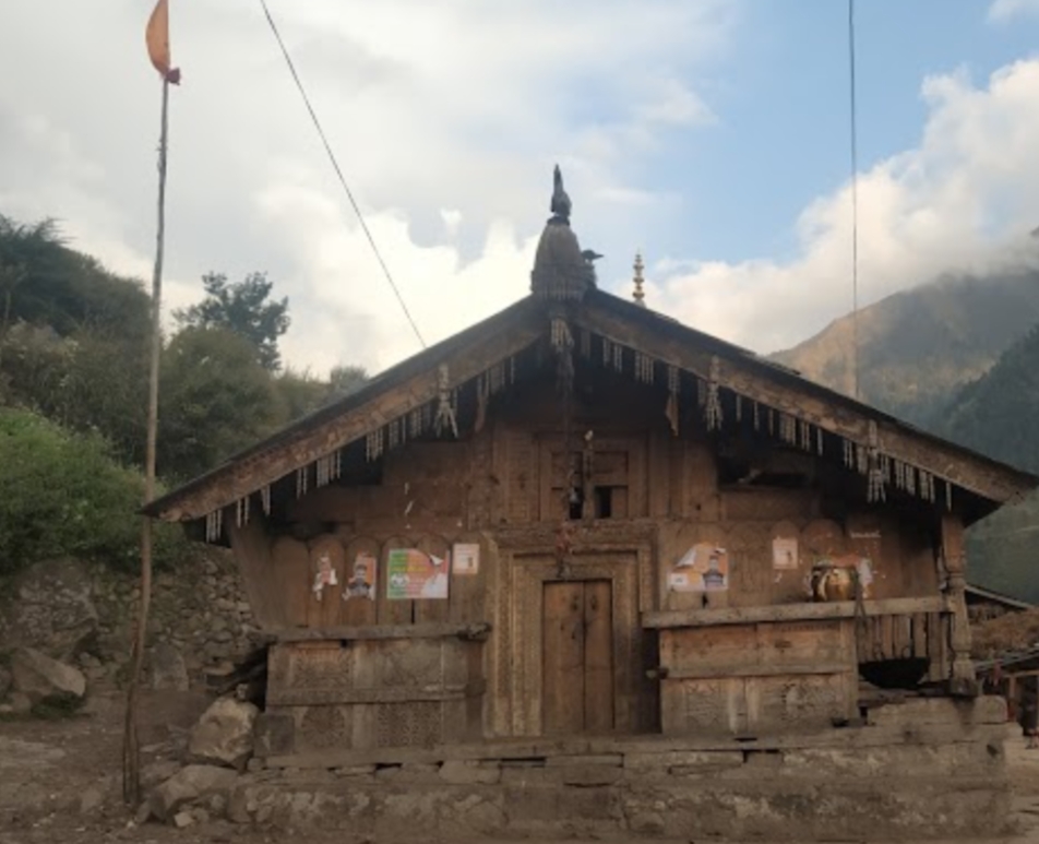
Next morning we woke up as usual and got prepared for our final destination. The G. S. I. Officers along with their porters, we four and the new gentleman who joined us yesterday all together a very big team in a word. All of us began to move after tea and breakfast. I was a bit worried about our accommodation for the night because I knew that Har Ki Doon bungalow had only one big room and it was not as big as that of Oslha. When I expressed this to my friends that somehow it would also be managed like last night and encouraged me to enjoy the journey and asked me, perhaps to divert my mind, about Oslha. We were walking together. Today’s march is only ten kilometers but we have to climb around three thousand feet. We followed the banks of Tonse and came to the confluence of ‘Har Ki Doon Nala’ and ‘Ruinsara Gad’ the two rivulets. The ‘Har Ki Doon Nala’ is coming from the Jamdwar glacier and the ‘Ruinsara Gad’ is coming from the ‘Ruinsara Tal’ or lake situated at the bottom of the Bandarpunch Range. These two rivulets form here the river Tonse. I narrated the origin and description of the rivers to my friends. I added that ‘Ruinsara Tal’ is around fourteen kilometers from the Seema forest bungalow. It’s a nice valley between Bandarpunch Range and Swargarohini Range and also the base camp for both the ‘Swargarohini Peak’ and the ‘Kalanag’ or the ‘Black Peak’. There is a Col or Pass between these two ridges named ‘Dhumdharkandi Pass’ that connects the two valleys, the Tonse Valley and the “Yamuna Valley’. We crossed the bridge on Tonse and left the confluence to the right bank of the Har Ki Doon Nala. A steep climb began. We came near the Oshla village. I insisted that my friends visit the temple of Duryodhan in the village. Everyone of us saw for the first time a temple of the local God in this region and got a touch of the local culture. The temple was completely made of wood and both the craftsmanship and the design were very attractive. We came back to our track leading to Har Ki Doon. The forest of the giant trees were left behind. Only bush and birch trees were seen now. Everyone was moving at one’s own pace. The trail to Ruinsara Tal was visible now from here on the other bank of the river Tonse. The two ranges of Mount Swargarohini and Bandarpunch were also visible. We were marching slowly but steadily on our way. There was no flat land, no village ahead, so no tea shop to rest for a while, we all walked and walked relentlessly. We all were walking together. At length we realised that there was no steep ascent, the track was almost flat, stretched through the grassland. We all were fatigued and paused for a while. I told my friends that J. T. M. Gibson visited the valley in 1948 and in his write-up published in the Himalayan Journal in 1954, he introduced this marvelous valley to trekkers and mountain lovers of the world. We came up on the grassland and noticed a number of colourful tents on the bank of the river. A group of foreigners came to enjoy the beauty of the place. The Swargarohini stood tall on the other bank of the river and a stream was coming from Jamdwar glacier pouring its water into the Har Ki Doon Nala and another stream, named Morinda was coming from left the Borasu Pass, which connected the Himachal Pradesh and the Uttarakhand. Mr. Gibson came from that side crossing the Borasu Pass. Later he came here on an expedition to Swargarohini and Black Peak with a group of students. When we arrived at the Har Ki Doon bungalow we found that the G. S. I. team had already arrived there. This bungalow was comparatively small containing one big room and below one separate kitchen. We were welcomed by the G. S. I. team and unleashed our rucksacks and took everyone a cup of tea. Today we prepared our food with the help of their cook. But we all had our lunch together. After lunch we came out of the bungalow for stroll around. We first walked along the stream coming from Borasu Pass. Tomorrow we shall go to the Jamdwar glacier. The glacier that comes down from Swargarohini. The name of the glacier is aptly given. Jamdwar means the gateway to the next world after death and Swargarohini means path to heaven. A silver thread like stream is coming down from the Jamdwar glacier through the picturesque valley at the foot of Swargarohini and pouring its water into the stream that coming from Borasu Pass and both the streams together form the Har Ki Doon Nala which again after meeting with the stream of the Ruinsara Gad at Oshla form the Har Ki Doon Nala. Har Ki Doon means the abode of Lord Shiva. In every sphere of the locality and life here there is a mythological references to Mahabharata. We came back to the bungalow. We were having a discussion with the G. S. I. officers. They would stay here for a week and conduct their survey work around both the regions. Tomorrow we shall go to the Jamdwar glacier along the stream as far as we can go and then we shall go back to Oslha.
Must Read: Up Hill, Down Dale by Asis Mukherjee
So after dinner we went to the kitchen and laid our matress and sleeping bags. Here we were five trekkers now. Rest of all stayed at the bungalow. In the morning when I woke up at the call of a porter I was awestruck at the first sight of the Swargarohini visible from my bed through the open doors just a few kilometers away. The rays of the morning sun were appearing behind it and black and snow white Swargarohini standing in front of me as if inviting me to the abode of God. I can never forget that moment in my life even after seeing many a sunrise either at the mountain or at the sea. I woke up at my bed and with the cup of tea enjoyed the beauty of the Har Ki Doon valley through the open door. After two three sips of tea the trance was over and I left my bed and packed up. In less than an hour we got ready and after another round of tea and biscuits set out for Jamdwar glacier. It’s flat trail and on our right side the Har Ki Doon Nala was flowing through the meadow silently aon its other bank stood the Swargarohini like a huge wall. This side of the Swargarohini is the Har Ki Doon valley and the other side of it is the Ruinsara Gad. We walked slowly towards Jamdwar glacier and gradually appeared at the morain of the glacier and saw the ice fall came down from Swargarohini and water was gushing out from the mouth of the glacier. We paused there for some time and took some snaps and returned. The valley, the mountain, the mythological references all were filled in the books and volumes of my memory but above all the most vivid picture was the dawn at Swargarohini. We returned from the Jamdwar glacier murmuring the song of Bob Dylan “Knock, Knock, Knocking on Heaven’s Door…”.
Must Read: Trimbakeshwar Temple: Nashik’s Most Powerful Shiva Temple
Must Read: Step By Step Towards The Hill by Asis Mukherjee
We came back to Har Ki Doon bungalow and had our lunch over there with the G. S. I. officers and without wasting time bade goodbye to our host the G. S. I. team and set out for Oshla. Still ten kilometers we had to trek and it’s midday now. But the trail was good and it was descending from 11,200 feet to 8400 feet. So we all comfortably reached the Seema forest bungalow at around 4 p.m. We checked in and asked Bhajan Sing, the chaukidar, to prepare tea for us. After tea break we all assembled at the balcony of the bungalow and exchanged our experiences and discussed our next day’s plan. So far everything happened so smoothly that we didn’t face any hazard in our trek.
Next morning we set out after breakfast. Today our four men team will break. Prasantada and Tarun will head for Jamuna Kanta, the pass over Bandarpunch Range and go via Jamunotri, the source of the Jamuna river and Pradip and myself and the aged gentleman from Kolkata will go for Taluka. We all started together and after coming a furlong they took the trail to Jamuna Kanta accompanied by a local guide and we wished them good luck and took our trail towards Taluka. In four hours and a half we reached Taluka bungalow. The chaukidar welcomed us and opened the doors. We checked in and asked him for tea and lunch. Sitting at the balcony of the bungalow we recapitulated our past few days’ trek. In the evening we came inside the room and helped the chaukidar to prepare our dinner.
Must Read: Just Another Day in Paradise (Sikkim) Asis Mukherjee
Early in the morning we set out after having a cup of tea only. Today’s is a long march of twenty kilometers. We had planned to have some food on the way. We tried to speed up from the beginning so that we could reach Netwar comfortably before evening. On the way we stopped at a shop for some food. We reached Netwar bungalow in the afternoon. Now on our return journey we felt the bungalow and the chaukidar very familiar. As we checked in the chaukidar prepared tea for us. We asked him to prepare our dinner also. We got together at the balcony of the bungalow and went on gossiping until evening fell. Tomorrow is the last leg of our trek. Prasantada and Tarun might have reached Jamunotri today. So they also will discend tomorrow to reach the roed head. They had to spend one night in the tent on their way. Next day morning we also started early so that we could catch the bus for Dehradun from Mori. On our way we again crossed the broken road and in the daylight we saw that it was completely washed out in the stream. On the very first day of our trek we could not realise the gravity of the damage. But now in the daylight it was frightening. Nevertheless we crossed it safely along with other villagers and appeared at the bus stand. Fortunately we got the bus also for Dehradun. In the trek in Himalaya, I’ve observed that if fortune gives you a stand you can overcome any odd situation. By grace of the God ‘Har’ or ‘Mahadev’, this time also we could complete our trek safely and came back from ‘Jamdwar’ or ‘Heaven’s Door’.
Must Read: Panwali Kanta The Pilgrim’s Progress – By Asis Mukherjee
We came back to Har Ki Doon bungalow and had our lunch over there with the G. S. I. officers and without waisting time bade good bye to our host the G. S. I. team and set out for Oshla. Still ten kilometers we had to trek and it’s midday now. But the trail was good and it was discending from 11,200 feet to 8400 feet. So we al comfortably reached the Seema forest bungalow at around 4 p.m. We checked in and asked Bhajan Sing, the chaukidar to prepare tea for us. After tea break we all assembled at the balcony of the bungalow and exchanged our experiences and discussed about our next day’s plan. So far everything happened so smoothly that we didn’t face any hazard in our trek.
Different Types of Seasons in India 2023 – Winter, Spring, Summer, Monsoon etc
Next morning we set out after breakfast. Today our four men team will break. Prasantada and Tarun will head for Jamuna Kanta, the pass over Bandarpunch Range and go via Jamunotri, the source of the Jamuna river and Pradip and myself and the aged gentleman from Kolkata will go for Taluka. We all started together and after coming a furlong they took the trail to Jamuna Kanta accompanied by a local guide and we wished them good luck and took our trail towards Taluka. In four hours and a half we reached Taluka bungalow. The chaukidar welcomed us and opened the doors. We checked in and asked him for tea and lunch. Sitting at the balcony of the bungalow we recapitulated our past few days trek. In the evening we came inside the room and helped the chaukidar to prepare our dinner.
Next day early morning we set out after having a cup of tea only. Today’s is a long march of twenty kilometers. We had the plan to have some food on the way. We tried to speed up from the beginning so that we could reach Netwar comfortably before evening. On the way we stopped at a shop for some food. We reached Netwar bungalow in the afternoon. Now on our return journey we felt the bungalow and the chaukidar very familiar. As we checked in the chaukidar prepared tea for us. We asked him to prepare our dinner also. We got together at the balcony of the bungalow and went on gossiping until evening fell. Tomorrow is the last leg of our trek. Prasantada and Tarun might have reached Jamunotri today. So they also will discend tomorrow to reach the roed head. They had to spend one night in the tent on their way. Next day morning also we started early so that we could catch the bus for Dehradun from Mori. On our way we again crossed the broken road and in the daylight we that it was completely washed out in the stream. On the very first day of our trek we could not realise the gravity of the damage. But now in the daylight it was frightening. Nevertheless we we crossed it safely along with other villagers and appeared at the bus stand. Fortunately we got the bus also for Dehradun. In the trek in Himalaya, I’ve observed that if fortune gives you stand you can overcome any odd situation. By grace of the God ‘Har’ or ‘Mahadev’, this time also we could complete our trek safely and came back from ‘Jamdwar’ or ‘Heaven’s Door’.
Must Read: 10 Travel Destinations in India by Rahul Banerjee